Mitigation bank search, made easy.
Wetland, stream, species and NRDA credits for any project site. Credits can only be sold to you by a bank whose approved service area covers your site — enter a location below and we resolve it, then list every bank that can actually serve it with the credits it has left.
Figures mirrored from USACE RIBITS · synced
Showing banks near , from your approximate location. Enter your project's own site above — service areas are decided by the exact point, not the town.Showing an example for . Enter a location above to search your own project site.
service-area match(es) in the live map had no bank record in the nightly index and are not listed here.
Find mitigation banks faster — six things RIBITS search won’t do for you
RIBITS — the Corps’ Regulatory In-lieu fee and Bank Information Tracking System — is public, free to search, and where our supply data comes from. Six things it won’t do for you:
Skip the coordinate hunt
RIBITS wants coordinates or a map click. We take map click, address, coordinates, or HUC code. Give us whichever you have — they all land in the same place:
Search in plain English
Wetland, stream or species — pick the plain term; we know every raw classification it hides behind.
See every option on one screen
One sortable table, every eligible bank on one map — not a stacked per-bank report.
| Bank | Service area | Avail. |
|---|---|---|
| Katy Prairie Stream | Primary | 13,994.46stream |
| Greens Bayou - HCFCD | Primary | 176.768wetland |
| Eastern Black Rail Conservation Bank at Chocolate Bay | Primary | 215.00species |
| Spellbottom | Secondary | 115.60wetland |
| Sand Hill Farm | Secondary | 83.10wetland |
| Mill Creek | Secondary | 70.46wetland |
See published prices up front
In-lieu fee rates, right in the results — per credit, from the sponsor’s own price sheet.
| Service area | Class | Rate |
|---|---|---|
| Etowah | Stream | $3,800 |
| Etowah | Wetland | $200,000 |
| Lower Flint | Stream | $3,200 |
| Middle Chattahoochee | Stream | $3,800 |
| Tennessee | Stream | $4,000 |
| Tennessee | Wetland | $1,600,000 |
| Upper Chattahoochee | Stream | $4,200 |
| Upper Ocmulgee | Wetland | $1,400,000 |
Filter out inactive banks at a glance
Steady sellers, comebacks, and stock with no recent sales — visible before you call.
| Bank | Sales | Avail. |
|---|---|---|
| Bunker Sands Mitigation Bank | 110 | 441.98wetland |
| Pineywoods | 63 | 3,760.80wetland |
| Burleson Wetlands Mitigation Bank (TXRAM 1.0 Bank) | 9 | 2,186.10stream |
| Halo Ranch Mitigation Bank | 4 | 172.25stream |
| Fall-Off Creek Mitigation Bank | 0 | 324,800.80stream |
| Big Woods on the Trinity Mitigation Bank | 0 | 1.60wetland |
Go deeper in one click
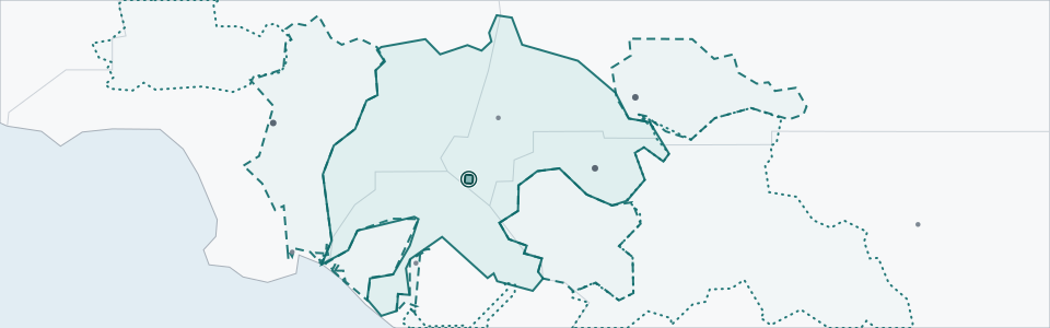
Every row opens the full bank page. In miniature:
Common questions
How do I find a mitigation bank for my project?
Enter your project's address, coordinates, or HUC-8 code above. A bank can only sell you credits if your impact site falls inside its approved service area, so the tool resolves your location and returns the banks whose service-area boundaries actually cover it — not simply the banks nearest to you.
What is a service area, and why does it decide eligibility?
A service area is the geographic region a mitigation bank is approved to sell into, set in the bank's instrument when the Corps approves it. It's usually drawn around one or more watersheds. If your project isn't inside a bank's service area, you generally can't use that bank's credits — however close it is, and however many credits it has.
What is a HUC-8 and why does the tool use it?
A HUC-8 is an 8-digit Hydrologic Unit Code — the USGS's identifier for a watershed of roughly 1,000 square miles. Because service areas are typically defined in watershed terms, resolving your location to its HUC-8 is what makes eligibility answerable. You can search by HUC-8 directly if you already know yours.
Can I buy credits from any mitigation bank?
No. Two things have to line up: the bank's service area has to cover your impact site, and the bank has to have the right kind of credit still available — wetland, stream, species, or NRDA. A bank can be approved and still have nothing to sell, either because its credits haven't been released yet or because it's sold out.
What's the difference between a mitigation bank and in-lieu fee?
A mitigation bank is a private site that sells credits at a negotiated market price. An in-lieu fee (ILF) program is a public or non-profit option that charges a published, administratively-set rate for the same obligation. Because the ILF rate is a posted price ceiling rather than a market transaction, we label it separately and never mix it into market pricing.
How much do mitigation credits cost?
It varies enormously — from a few thousand dollars per credit to several hundred thousand, sometimes within the same state — because price tracks the credit type and how scarce supply is in your watershed. See our national breakdown of what wetland mitigation credits cost.
About the data on this page
Bank details, status and credit balances are mirrored from the USACE RIBITS registry, the federal public record for mitigation banks. Single-client banks are excluded from supply figures. What we call a “credit sale” is a credit withdrawal — the entry written in the federal credit ledger when credits are committed to a permit. At commercial banks a withdrawal generally represents a sale; at a single-client bank it offsets the sponsor’s own project. The figures count ledger transactions, not distinct purchases — one purchase may produce several withdrawals — and we count entries rather than credits moved, because credit classes are different units and cannot be added together. Each bar in a sales chart counts the credit sales recorded in that calendar year — withdrawals from the federal ledger, not quantities of credits. The final bar is the year in progress and is shown in a different color. No bars means no sales in those years.
RIBITS provides credit type and credit classification for each bank listing which we display verbatim. The topic labels and headings you see are ours — we group those names so you can more easily find what you need. For example, five banks selling the same kind of wetland credit may record their classification as “Palustrine Forested”, “PFO - Palustrine Forested”, “Forested Wetland”, “Forested Wetlands” or just “Forested”; we gather all five under one Forested label.
Eligibility and map come live from the EPA NEPAssist RIBITS MapServer and the USGS Watershed Boundary Dataset each time you search. Your search runs in your browser and we don’t store anything about it. A service area is ranked primary, secondary or tertiary by the Corps, and we show that ranking the way RIBITS does: one list ordered by rank and then distance, with a labeled badge on the secondary and tertiary rows. Primary rows are unbadged — we mark the exception, not the norm. The rank does not settle eligibility for your project; the Corps and the sponsor do. The watershed a search resolves your point to comes from the USGS Watershed Boundary Dataset, which turns a HUC-8 code into the polygon most service areas are drawn around — a finer grain than the HUC-6 basins the analysis pages group by. Some banks have no service-area boundary in the EPA NEPAssist RIBITS MapServer, and no location search can return them. That is a gap in the mapping layer, not a statement about the bank: it may be approved, open, and able to sell exactly where you are. We list these separately rather than dropping them. The rates are not from RIBITS — the federal registry publishes no in-lieu fee price. Each one was transcribed by hand from the program’s own published fee schedule, which is linked beside it, and carries that schedule’s effective date. Schedules are updated when the program republishes, not on a set cycle, so a rate may be several years old and still be the current one. This is an administrative list price, set by the program sponsor as the regulated cost of meeting a permit obligation. It is not a market rate for a mitigation bank credit and should not be read as one. Comps are documented purchases, confirmed against the RIBITS ledger where the transaction can be matched.